When Water Was Edinburgh's Lifeline: The Ancient Ferry Routes That Built Scotland's Capital
In the shadow of Edinburgh Castle, where tourists now photograph the Scott Monument and shoppers throng Princes Street, lies a forgotten geography written in water rather than stone. Long before the Forth Road Bridge became Scotland's gateway to the north, Edinburgh's relationship with its waterways defined not merely where its citizens lived and worked, but how the city's very character emerged from the ebb and flow of tides, the seasonal rhythms of rivers, and the daily crossings that connected communities across the Lothians.
The Nor' Loch: Edinburgh's Lost Heart
Where Princes Street Gardens now provide a verdant respite from the capital's bustle, the Nor' Loch once stretched like a dark mirror beneath the Castle Rock. This artificial loch, created in the 15th century by damming the Nor' Burn, served as far more than Edinburgh's northern boundary. It was the city's liquid highway, connecting the Old Town's merchants to markets and mills along its shores.
The loch's ferry crossings became vital arteries for Edinburgh's growing population. Small boats carried everything from Highland cattle destined for the Grassmarket to bolts of cloth bound for the Royal Mile's tailors. The ferryman's cry of "Boat ahoy!" echoed across waters that reflected not only the castle's imposing silhouette but the ambitions of a nation's capital seeking to expand beyond its medieval walls.
These crossings shaped the social fabric of early Edinburgh in ways that persist today. The northern shores of the Nor' Loch attracted settlements of craftsmen and traders who relied on the water route for their livelihoods. When the loch was finally drained in the 18th century to make way for the New Town's geometric grandeur, the ghost of these communities remained embedded in street names and property boundaries that modern Edinburghers navigate without realising their aquatic origins.
The Forth's Ferry Kingdom
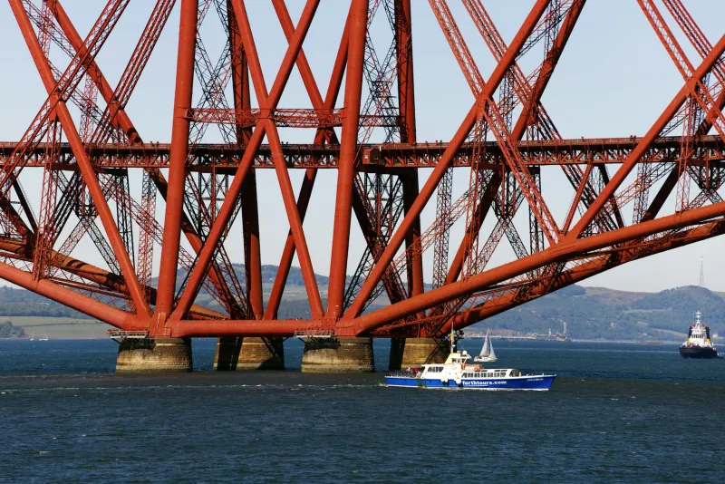
Beyond Edinburgh's immediate boundaries, the Firth of Forth commanded a network of ferry routes that made the city the hub of Scotland's eastern trade. The crossing at Queensferry, immortalised in Robert Louis Stevenson's Kidnapped, represented just one strand in a web of water routes that connected Edinburgh to Fife's coal mines, Stirling's cattle markets, and the North Sea's fishing grounds.
The ferries of the Forth were not merely functional vessels but floating communities unto themselves. The ferryman's house at South Queensferry, with its distinctive red pantile roof still visible today, served as an unofficial customs house, inn, and information exchange. Here, Edinburgh merchants learned of ships arriving from the Low Countries, Highland drovers discovered the best prices for their cattle, and travellers from across Scotland gathered news of the capital's markets and opportunities.
These crossings created Edinburgh's first truly international connections. Dutch merchants, Flemish weavers, and German craftsmen all arrived via the Forth ferries, bringing skills and customs that enriched the city's cultural tapestry. The influence of these maritime arrivals can still be traced in Edinburgh's architecture, from the crow-stepped gables of the Royal Mile to the distinctive red sandstone that became the city's signature building material.
Markets on the Water's Edge
Edinburgh's relationship with water extended beyond transportation to commerce itself. The Fleshmarket Close, descending steeply from the High Street towards the valley that once held the Nor' Loch, takes its name from the meat markets that clustered near the water's edge. Here, cattle ferried across the loch met butchers who served the growing population of the Old Town's tenements.
These waterside markets operated according to rhythms older than any royal charter. The twice-weekly cattle crossings determined when fresh meat appeared in Edinburgh's closes and wynds. The seasonal arrival of herring fleets in the Forth dictated feast and famine in the city's diet. The spring floods that made some ferry crossings impassable created temporary shortages that shrewd merchants learned to anticipate and exploit.
The archaeological record reveals the extent to which Edinburgh's economy depended on these water routes. Excavations near the old loch shore have uncovered medieval fish bones from species that could only have arrived by boat, pottery shards from kilns accessible only by ferry, and coins from kingdoms connected to Edinburgh through its maritime networks.
The Liquid Legacy
Though Edinburgh's ancient waterways have long since been drained, bridged, or forgotten, their influence permeates the city's modern geography. The curve of Princes Street follows the natural contour of the Nor' Loch's southern shore. The narrowness of certain closes in the Old Town reflects the medieval priority of maintaining clear sight lines to ferry crossings below. Even the New Town's famous grid pattern acknowledges the constraints imposed by the city's original relationship with water.
Today's visitors to Edinburgh, hurrying between the castle and Holyrood Palace or climbing the Mound towards the galleries of the Royal Scottish Academy, unknowingly trace routes first established by ferry passengers and water-borne merchants. The city's character—its blend of Highland and Lowland, its mixture of international sophistication and local tradition, its capacity to reinvent itself while honouring its past—emerged from centuries of daily crossings that connected Edinburgh to Scotland and Scotland to the wider world.
In recognising these forgotten water routes, we glimpse Edinburgh not as a monument frozen in time but as a living city whose stones remember the sound of oars on water, whose closes echo with the cries of ferryman, and whose very soul was shaped by the ancient understanding that water, not walls, determines a city's true boundaries.
Tracing the Watermarks
For the curious visitor willing to look beyond Edinburgh's obvious attractions, traces of this liquid heritage remain visible throughout the city. The sudden width of certain streets marks where ferry passengers once gathered. The positioning of the city's oldest churches reflects the medieval understanding that congregations would arrive by water as well as land. Even the famous Edinburgh winds, channelled through the city's closes and wynds, follow patterns first established by the topography of long-vanished lochs and streams.
This water-written history of Edinburgh offers a different way of understanding Scotland's capital—not as a collection of tourist sites but as a place where geography, commerce, and community combined to create something uniquely Scottish and enduringly human.